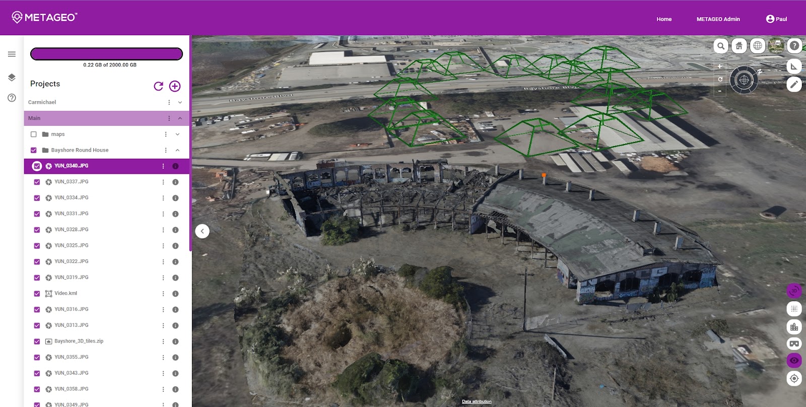
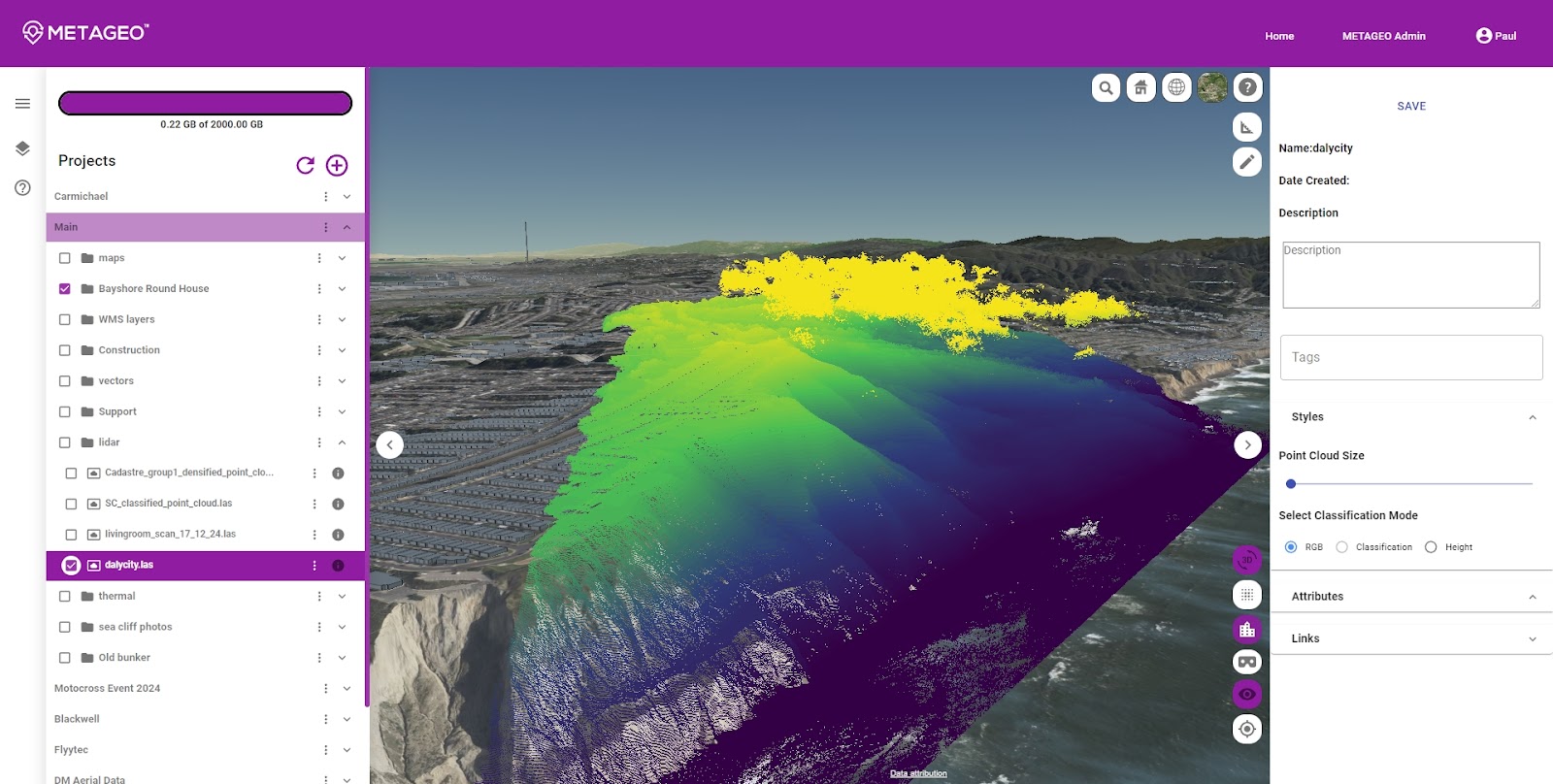
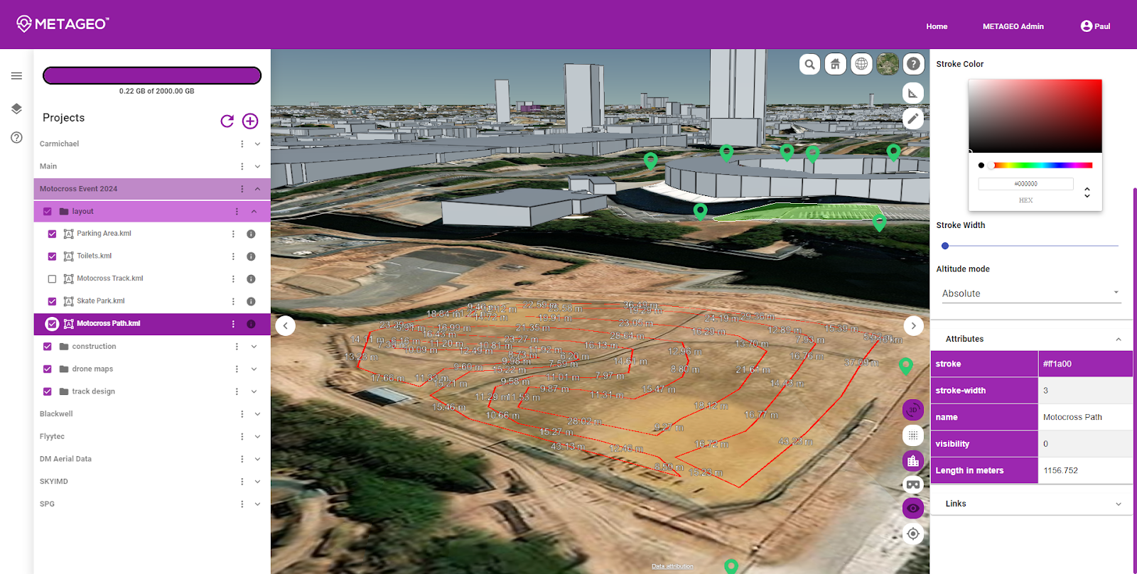
METAGEO, is a next gen map platform, that is now open to the public as a beta. The product solves the issues of traditional map platforms by simultaneously showing 2D and 3D location-based data such as photos, point clouds, 3D models and more, in most common open-source formats. The platform allows multiple users to collaborate live, using any device with a web browser (Android, iOS, Mac, PC, AR / VR).
Historically, map (GIS) platforms have been very complex.
It requires several months of training to master, and the map data is big, hard to find, and hard to share. Moreover, each data type requires a unique software. These barriers, coupled with high costs, have limited the reach of mapping technology to technical staff, leaving executives and field workers to use printed maps.
METAGEO solves these issues, the platform hosts maps, and sensor data, combining it into a single 3D virtual environment.
It enables users by providing tools for annotation, communication, and analytics. This environment can then be streamed to any internet-connected device without installing software. With seamless import and synchronization, METAGEO assembles data from satellites, drones, mobile devices, public and crowdsourced repositories, IoT sensor data and 3D models, and updates the map in real time. The platform is building a library to help users better find current and historical datasets, and will include a premium marketplace for 2D and 3D datasets, such as Aerometrex’s 3D model of San Francisco.
With this technology, users across industries can streamline workflows and improve efficiency. Construction and engineering professionals can use the platform to plan and manage construction sites and share information with those in the field. Workers in the field can update the map live with critical information, inspection photos and more, giving immediate information to managers and stakeholders. City governments can optimize the layouts of events and maps for disaster management and share maps with different departments. Public safety officials can view building information, imagery, and load layouts of buildings for planning operations, and view direct photos or videos from drones. The use cases for the platform are innumerable, with further applications in academia, architecture, energy, environmental conservation, and more.
Paul Spaur, founder of METAGEO, says the platform’s timely release bridges a growing gap in the market. “After working with 3D map data for several years, it became apparent that there was no easy way to share big datasets with those who need the information most–those with the boots on the ground,” he writes. “Now with the rapid advancement of mobile hardware, and using advanced processing techniques, we can leverage this data in real life, in real time.”
Users can create a free account today, which will allow them to upload images, rasters, vectors, point clouds, and 3D meshes. The platform is equipped with tools to draw on maps, take measurements, make annotations, and invite other team members to view the data live.
METAGEO is now available for use and subscription.
METAGEO is available for pre-purchase in several affordable subscription tiers, and is free for education.


